India Unveils $77 Billion Hydro Plan Amid Geopolitical Competition With China

.
India’s Central Electricity Authority (CEA) has announced a $77 billion master plan to develop hydroelectric plants in the Brahmaputra Basin to counter China’s upstream mega dam project.
This marks India’s latest move in an ongoing competition for the control of waters originating in Tibet between the two countries, which analysts say goes beyond mere hydro power development to deeper economic and geopolitical tensions, especially decades-long border disputes.
India’s master plan aims to develop 76 gigawatts (GW) of hydroelectric capacity in the Brahmaputra Basin at a cost of 6.4 trillion rupees ($72 billion) by 2047, the CEA announced on Oct. 13. Phase one of the plan, running until 2035, is projected to cost 1.91 trillion rupees ($21.7 billion), with phase two costing 4.52 trillion rupees ($51.35 billion).
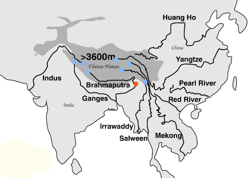
The Brahmaputra River, which starts in Tibet and flows through India and Bangladesh, holds substantial hydroelectric potential, particularly in Arunachal Pradesh, near the India–China border. The upstream stretch of the river in Tibet is known as the Yarlung Tsangbo River.
The Brahmaputra basin has more than 80 percent of India’s untapped hydro potential. Arunachal Pradesh alone has the potential to produce 52.2 GW. In comparison, the Three Gorges Dam, the largest hydroelectric dam in China, has a capacity of 22.5 GW.
The CEA said the plan includes 208 large hydro projects across 12 sub-basins in the northeastern states. Among the 12 sub-basins, Dibang (8,801 MW), Siang (18,666 MW), Lohit (6,841.5 MW), Subansiri (12,290 MW), Kameng (3,258), Teesta (6,804 MW), and Barak (4,627.2 MW) are considered major sub-basins.
Renowned Chinese hydrologist Wang Weiluo, who is based in Germany, told The Epoch Times on Oct. 17 that India’s $77 billion plan is only an investment into the hydropower transmission system. “India’s CEA has not disclosed the total investment in the 200-plus large hydropower projects, but the figure is likely much higher, perhaps five to 10 times the investment in the transmission system.”
The mega dam construction project is aimed more at stimulating a Chinese economy that has been sluggish since the COVID-19 pandemic than meeting a need for hydropower, as Wang pointed out that China has a surplus of electricity.
On Oct. 17, international observers pointed out that since the launch of the construction of the Yarlung Tsangbo dam in July, it hasn’t shown any sign of reviving China’s previous growth momentum, as low investor and consumer confidence, slumping domestic demand, production overcapacity, and deflation linger.
Analysts say that competition over the control of resources of the Yarlung Tsangbo/Brahmaputra River is more about geopolitical competition.
In order to increase its geopolitical influence in the region, India deliberately announced its master hydro plan now, Hung Ming-te, associate research fellow at Taiwan’s Institute for National Defense and Security Research, told The Epoch Times on Oct. 15. Besides the ongoing border disputes with China, “there have been increasing tensions in India–Bangladesh relations, as Bangladesh is moving closer to Pakistan,” he said.
.
Strategically Important Location
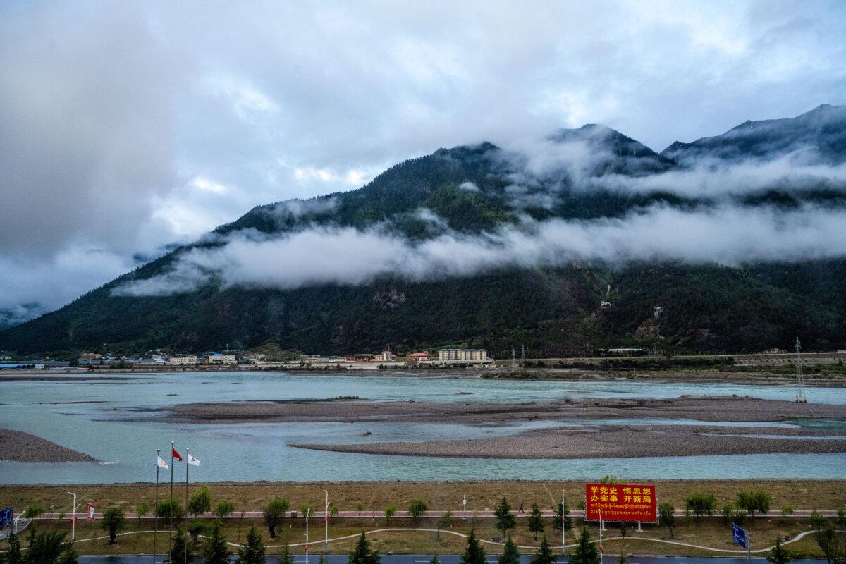
Medog County, Tibet, is less than 12 miles away from Arunachal Pradesh, India.India’s plan is a response to China’s mega dam construction on the lower end of the Yarlung Tsangbo River, Wang said.
“Among the more than 208 large-scale hydropower projects is a major hydropower station, the Siang River Hydropower Project, located downstream of the Yarlung Tsangbo River after it flows out of Medog,” he explained. “This project has a technical impact on China’s hydropower projects on the lower reaches of the Yarlung Tsangbo River, primarily due to reservoir backflow, which will affect China’s choice of dam site in Medog.”
For more than a decade, the Chinese communist regime has repeatedly expressed opposition to India’s construction of a dam at this location, Wang said. “It seems the Indian government is determined to build this large hydropower station this time.”
According to videos released online about China’s mega dam, “the lowest level hydropower station of the Yarlung Tsangbo River dam project is located in the southern part of Medog County, very close to the China–India border,” Wang noted.
.
A week before India announced the plan, 163.com, a major Chinese state-controlled media outlet, posted a commentary on Oct. 7 titled “Why Must the Yarlung Tsangbo River Dam Be Built Now? It’s Now or It will Be Too Late!”
The commentary stated, “In the current context of climate change and water shortages, whoever builds dams, diverts water, and generates electricity near the source will have control.”
It admitted that “India’s concern that China might control the flow of water is not a conspiracy theory, but a geopolitical reality.” The justification was that “if China doesn’t build hydropower dams upstream, China could be put on the defensive if India started building large-scale water conservancy projects downstream or uses technological means to control the flow of water.”
It added that building a hydropower dam in the region is “a strategic anchor,” and that “it’s more than just a power generation facility; it also represents a nation’s presence.”
Disputed Borders
There are three different demarcation lines between China and India.The first one is the Sino–Indian border marked on the Chinese map, in which the southern Tibet region, also known as Arunachal Pradesh in India, is Chinese territory. China’s hydropower projects along the lower reaches of the Yarlung Tsangbo River are designed based on this line, according to Wang.
The second line is the McMahon Line, which is accepted internationally as the Sino–Indian border but is not recognized by the Chinese regime. According to the McMahon Line, Southern Tibet or Arunachal Pradesh is Indian territory. “This significantly shortens the length of the Yarlung Tsangbo River and reduces its flow in China,” Wang said.
The third line is 12.4 miles into China from the McMahon Line. After the Sino–Indian border war in the 1960s, then-Chinese Communist Party (CCP) leader Mao Zedong ordered the Chinese People’s Liberation Army to retreat 12.4 miles north of the McMahon Line. This marks the actual control line of the Sino–Indian border now, as India has actual control of the area, Wang said.
“Now, the CCP intends to use the construction of the world’s largest hydroelectric station in the region to reignite border conflict and pave the way for the recapture of southern Tibet,” Wang said.